
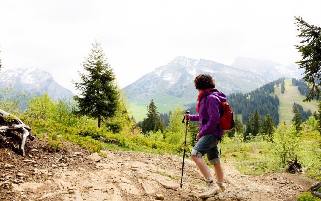
Starting from the mountain can also be a way to get back to yourself.
There’s no need to climb a peak to feel that you’ve come a long way. Sometimes, starting simply means putting on some sneakers, packing a small backpack, and choosing a path. Walking allows you to slow down, observe what’s around you, and regain a more gentle relationship with our bodies.
And Spain is a privileged setting for doing so: there are thousands of kilometers of marked trails and a huge variety of landscapes, from forests and valleys to coasts, volcanoes and glacial lakes.
For beginners, the key is not to seek the most spectacular or demanding route, but rather one that allows you to enjoy the journey without turning it into a competition. Here are some particularly interesting options for taking your first steps:
1. Senda del Agua, Cercedilla: a first introduction to the mountains
If you are looking for a simple route near Madrid, the Senda del Agua can be a good starting point.
The route starts in Cercedilla, in the Sierra de Guadarrama, and has about 10 kilometers between the return journey. Spain Tourism describes it as a simple route suitable for all audiences, with views over the valley and the port of la Fuenfría.
It is a good option to start experimenting with gentle slopes and walking for several hours without venturing into technical trails yet.
Furthermore, it has something important when we are just starting out: it allows us to focus on the experience of walking.
Ideal for: a first mountain route without major difficulties.
📊 Technical Sheet – Senda del Agua (Cercedilla)
- Distance: 4.93 km
- Desnivel +: 161 m
- Difficulty: Easy
- Type of route: Circular / Introduction
2. Camí de Cavalls, Menorca: walking along the Mediterranean
Not all hiking routes for beginners have to take us to high altitudes.
The Camí de Cavalls runs along the coast of Menorca for 185 kilometers, divided into 20 stages of approximately between 5 and 13 kilometers each. The great advantage for those starting out is that it is not necessary to complete the entire route: you can choose an individual stage and adapt it to the time and physical condition of each person.
Forests, coves, cliffs, beaches and lighthouses turn the path into an experience where the landscape is part of the journey itself.
It is a good way to discover that hiking isn't just about climbing mountains. It can also be walking along the sea, stopping to breathe and continue on.
Ideal for: those who prefer to start walking on coastal terrain and combine nature and landscape.
📊 Technical sheet – Camí de Cavalls (Menorca)
- Distance: 185 km (divided into 20 stages of 5 to 13 km each)
- Desnivel: Variable depending on stage (predominance of flat/smooth terrain)
- Difficulty: Easy – Moderate (adaptable)
- Type of route: Coastal route / In stages
3. La Fortaleza on Teide: discovering the volcanic landscape
The Teide National Park offers 41 marked trails, with very different levels of difficulty. Among them, the La Fortaleza route stands out for its 5.5 kilometers and its low difficulty.
It is an especially interesting option to experience a completely different landscape: the volcanic environment of Tenerife.
That said, just because a route is simple doesn't mean that planning has to be forgotten. Altitude, sun exposure, and weather conditions can all change the experience, so it's advisable to check the park's information before setting off and to bring water, sunscreen, and appropriate equipment.
Ideal for: those who want to start off in a unique mountain environment without tackling a route with high difficulty.
📊 Technical sheet – La Fortaleza (El Teide, Tenerife)
- Distance: 5.5 km
- Desnivel: Mild / Moderate
- Difficulty: Low
- Type of route: Lineal / Volcanic landscape
4. Vega de Llos, Picos de Europa: forest, mountains and wildlife
The Picos de Europa may seem, at first glance, a destination reserved for experienced hikers. But the National Park also offers low-difficulty trails.
One example is the Vega de Llos route, a circuit of 13.5 kilometers and about four hours in duration, officially classified as of low difficulty. The route passes through the Valdeón valley and allows you to enjoy beech forests, mountain landscapes, and the opportunity to observe red deer.
It is a route that allows you to take a step forward after having completed simpler hikes, although its 13.5 kilometers make it advisable to already have some experience in hiking.
Ideal for: those who want to move from short routes to a full day of hiking.
📊 Technical Profile – Vega de Llos (Picos de Europa)
- Distance: 13.5 km
- Accumulated difference: Moderate
- Difficulty: Lower – Medium (requires some walking habit)
- Type of route: Circular / Beech forest and mountain
An important warning: not everything famous is suitable for starting a business.
The Cares Route, for example, is one of the most well-known hiking trails in Spain. However, the Picos de Europa National Park classifies it as of medium difficulty and warns that, although the route is straightforward, its length can be demanding for unprepared hikers. There are 21 kilometers in the entire route between Posada de Valdeón and Poncebos.
Therefore, if you are just starting out, it is better pay attention to the distance, the elevation difference and the official difficulty before being carried away solely by the photographs of a route.
5. Garganta de los Infiernos, Jerte Valley:
The Natural Reserve of the Throat of the Infiernos, in the Jerte Valley, offers another interesting option: choosing how much you want to walk.
The complete circular route has 16 kilometers and a duration of about six hours. But there is a much shorter alternative from the Interpretation Center to Los Pilones: 2.5 kilometers each way, for a total of 5 kilometers, suitable for all audiences and without significant elevation changes.
This possibility of adapting the route is especially interesting when you still don't know how your body will respond after several hours of walking.
Ideal for: trying a short route and deciding on the spot if you want to expand the experience.
📊 Technical Sheet – Los Pilones / Garganta de los Infiernos (Jerte Valley)
- Distance: 5 km (short version round trip to Los Pilones) / 16 km (complete circular route)
- Desnivel +: Soft in the short version
- Difficulty: Baja (suitable for beginners)
- Type of route: Linear or circular / Landscape of riverbed and nature reserve
How to choose a hiking route if you are just starting out?
Rather than asking you which is the “most beautiful route,” it might be more useful to ask you which route suits you best. Before choosing, consider five aspects:
- Distance. For a first experience, it is preferable to stay short rather than end up completely exhausted.
- Desnivel. Kilometers don’t tell the whole story. A short route with a lot of elevation gain can be considerably more demanding than a longer, practically flat route.
- Type of land. It is not the same to walk on a forest track than on rock, uneven terrain or narrow paths.
- Planned duration. Always check the estimated time and add some leeway for breaks.
- Meteorology. The mountain can change quickly. Check the forecast before leaving and adjust the plan if conditions are not suitable.
The Local approved trails, Those identified with green signs and distances of less than 10 kilometers are precisely those that Turismo de España indicates as the most recommended for their low difficulty for people with a lower level of physical fitness.
What to bring on a first hiking route
You don't need to pack a backpack to enjoy a simple route… If, over time, you decide to take the step towards more complex routes or multi-day hikes, you can consult our guide to organizing an adventure trip safely. But that said, it’s a good idea to bring at least:
- Enough water.
- Something to eat or a snack.
- Suitable and comfortable footwear
- Clothing adapted to the weather forecast.
- Sunscreen.
- Mobile phone with battery.
- Route information or a map.
- A small backpack that doesn't feel uncomfortable.
On mountain trails, it is also important to inform someone about your planned route and check the conditions of the trail before setting off.
And there is another element that does not appear on any list of materials: Listening to the body. If you need to stop, stop. If you need to rest, rest. If a route becomes too demanding, turning around is also a good decision.
Hiking after cancer
For many women who have been through cancer, regaining movement can be part of a new stage. But there is no single pace of recovery.
The Spanish Association Against Cancer He points out that adapted physical activity can provide benefits during and after treatments, including improvements in quality of life, muscle strength, and certain psychological aspects. He also recommends increasing activity gradually and adapting exercise to each person's individual condition. Despite this, there are still False myths about sports and cancer that lead many people to limit their movement out of fear.
The World Health Organization It recommends that adult cancer survivors engage in physical activity on a regular basis when possible and without contraindications, starting with small amounts and gradually increasing the frequency, intensity, and duration. It also notes that needs may vary depending on the abilities, limitations, medication, and treatment of each individual.
Therefore, a hiking route should not be seen as a challenge to be overcome. It can simply be a way to get back on track, regain confidence, and enjoy the surroundings.
If you are undergoing treatment, have recently finished treatment, or have any cancer-related sequelae, consult your healthcare team before undertaking any mountain activity and always adapt the route to your situation.
Walking without haste: the true goal
Hiking can be a sport, but it can also be a break. An opportunity to discover a landscape. To chat. To be in silence. To recover your energy. Self-esteem and confidence after cancer And remember that moving forward doesn't always mean doing it quickly.
In the Pelayo Vida Challenge, movement and adventure are part of a transformation process that proves that boundaries can be changed. The expeditioners have traveled through deserts, mountains, glaciers, and seas, but behind every expedition there is something more important than reaching a destination: regaining the enthusiasm to continue exploring. If you want to know more History of the Pelayo Life Challenge, We invite you to discover how a conversation in 2015 changed everything.
Because maybe the next great adventure doesn't have to start at a summit. It can start with a trail.
Frequently Asked Questions
There is no universal distance. To begin with, a short route, well-marked and with little elevation gain, allows you to see how your body responds and gradually increase the difficulty.
For the first routes, especially in the mountains, it is advisable to go accompanied. It is also important to inform someone about the route and check the conditions before leaving.
Physical activity can be part of an active life after cancer, but it must be adapted to the individual situation. If there are any sequelae, recent treatments, or doubts about the appropriate intensity, consult the healthcare team beforehand.